




Africa’s landscapes hold Earth’s oldest records, from South Africa’s Vredefort Dome, the world’s oldest and largest known meteorite-impact structure, to Kenya’s volcanic Rift Valley lakes.
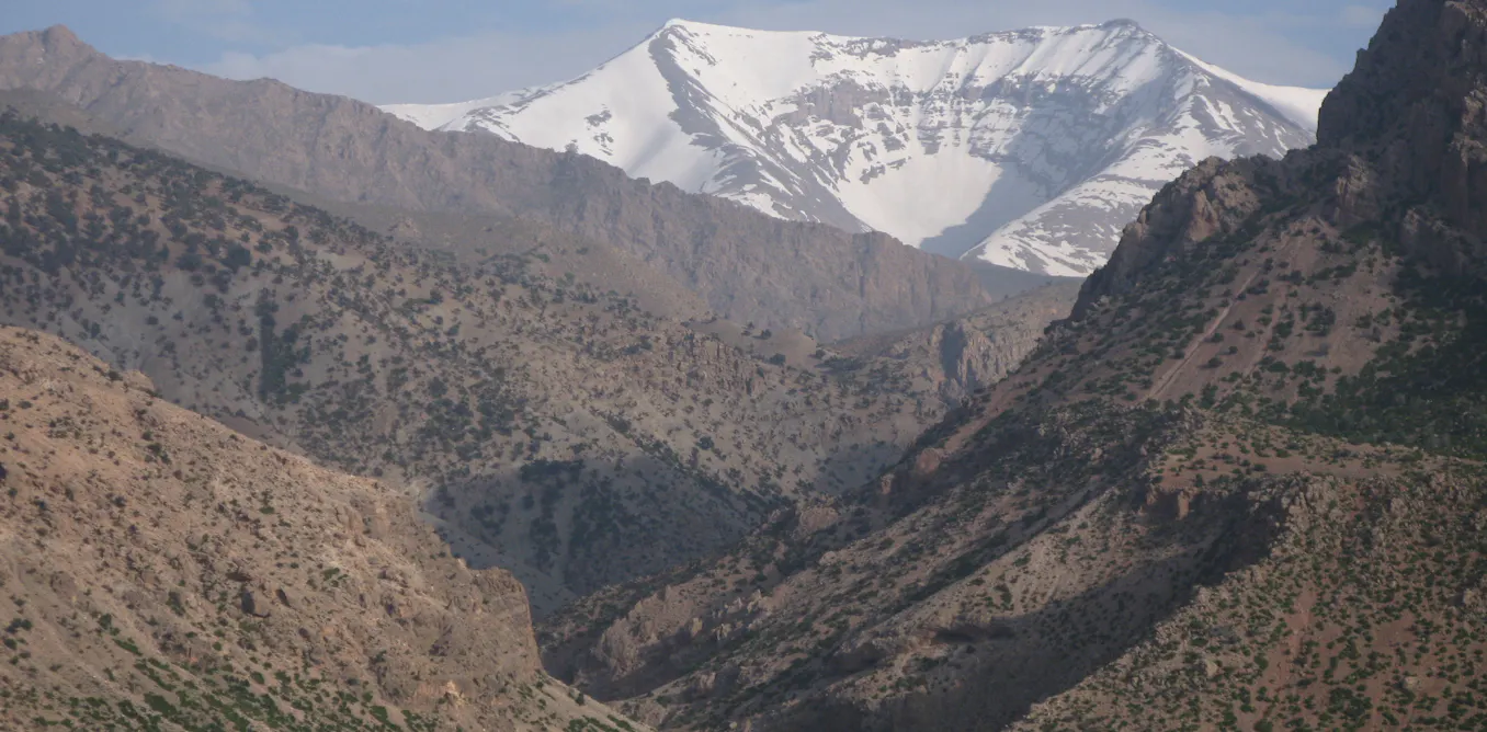
Morocco’s M’Goun Unesco Global Geopark alone preserves more than 200 million years of geological history, while Tanzania’s Ngorongoro-Lengai landscape combines a vast caldera, an active volcano, and the fossil-rich Olduvai Gorge.
These sites are more than scenic landmarks. Their rocks, fossils, caves, craters, and river valleys hold evidence of ancient climates, vanished environments, and human origins.
Together, they form part of Africa’s geoheritage: geological features with scientific, educational, and cultural value.
Yet much of this heritage remains poorly documented and unevenly protected. Many African countries lack formal inventories of important geological sites.
Legal protection is inconsistent, public awareness is limited, and responsibility is often split among geological surveys, universities, conservation agencies, and tourism authorities.
When a place is missing from an inventory or map, it is also more likely to disappear online. It may never be photographed systematically, modelled in three dimensions, or added to searchable databases.
That makes it harder for researchers, teachers, visitors, and funders to find. The under-representation of African journals in major academic databases deepens the problem.
Kamaldeen O L Omosanya, a research fellow at the University of Western Cape in South Africa, a geoscientist, and founder of DigGeoNaija, has examined this issue.
In a recent study, he analysed the visibility of Africa in the international literature on digital geoheritage.
Around the world, heritage managers are using geographic information systems (GIS), satellite imagery, drones, photogrammetry, laser scanning, 3D modelling, virtual reality, and artificial intelligence to record and explain geological sites. These tools can reveal erosion, quarrying, and vandalism.
They can also give students and researchers access to places that are distant or fragile, while helping visitors understand a landscape before they arrive.
A global digital transformation, with Africa at the margins
There are African projects that show what is possible. At M’Goun, researchers created digital records for 13 geological sites, combining photographs, location data, and descriptions in an interactive map.
The geopark also offers 360-degree virtual visits to selected geosites.
The African Fossils virtual laboratory is another example. Anyone with an internet connection can examine 3D models of fossils, ancient tools, and other objects, many from the Lake Turkana region of Kenya.
Lake Turkana and its surrounding basin are internationally important to the study of human origins because of the fossils and archaeological material discovered there. Some of the digital models can also be downloaded for 3D printing.
This does not replace museums, local guides, or field visits. Instead, it broadens access and can encourage deeper engagement with the landscapes and communities behind the material.
What my study found
Omosanya analysed publication records in Scopus and Web of Science, two major academic citation databases, searching for research about geoheritage sites. This was not a complete census of every African project, community initiative, or unpublished archive.
But it measured Africa’s visibility in influential indexed research on geoheritage.
The result was striking. The global Scopus search returned 885 publications, but only 31 were Africa-related.
Web of Science returned 534 publications, of which 20 concerned Africa. In both datasets, Africa accounted for fewer than 4% of the results from 2001 to 2025.
No African country appeared among the ten leading global contributors or case-study locations. Within Africa, publications were concentrated mainly in Morocco, Egypt, and South Africa, with Ethiopia also more visible than most countries.
Many nations with major fossil, volcanic, desert, and impact-crater landscapes had little or no representation.
Why digital visibility matters
This does not rank the value of any country’s geological heritage. The pattern probably reflects unequal funding, limited access to equipment, differences in institutional capacity, international partnerships, and the greater likelihood that research from some countries reaches indexed journals.
Visibility influences what gets researched, funded, taught, and protected. Closing this gap is about providing better evidence for conservation, education, tourism, and local decision-making.
First, documentation supports protection. Decision-makers cannot safeguard what has never been identified or assessed.
A geosite may be damaged by mining, road construction, uncontrolled collecting, urban growth, or poorly managed tourism before its value is understood. Digital records cannot stop destruction, but they create evidence of a site’s importance and condition.
Second, visibility can create economic opportunity. Geoheritage can expand African tourism beyond wildlife, beaches, and major monuments.
When carefully managed, places such as Baringo and M’Goun can support local guides, accommodation, museums, transport, crafts, and food businesses. The benefits must be shared with communities.
Third, digital resources make Earth science more relevant to African students. A learner should be able to study volcanic landforms in Tanzania, Nigerian inselbergs, Ethiopian fossil sites, or Saharan landscapes through maps and models.
Africa’s evidence also matters to global science. Without it, our understanding of Earth’s history remains incomplete.
What needs to happen next
The answer is not simply to buy expensive virtual-reality equipment. The first task is to build reliable, searchable inventories of geological sites.
Governments, universities, geological surveys, tourism agencies, and conservation bodies need shared methods for identifying sites, assessing their significance, and recording threats.
There are foundations to build on. Unesco has supported capacity-building and aspiring geoparks such as Baringo.
M’Goun has shown how field information can become a useful public map. In Nigeria, DigGeoNaija is developing a university-linked programme for GIS documentation, virtual interpretation, and promotion, with Olumo Rock as an early pilot site.
Investment in people matters as much as technology. Young African geoscientists need training in mapping, remote sensing, drone surveying, 3D modelling, database management, and public communication.
They also need skills in preserving files, managing metadata, securing community consent, and maintaining platforms after funding ends.
Regional collaboration could lower costs through shared standards, multilingual platforms, equipment centres, training programmes, and repositories. Research searches must also extend beyond Scopus and Web of Science to African Journals Online, institutional repositories, and national publications.
Most importantly, local communities must be partners from the beginning. Geological sites are often tied to oral histories, spiritual traditions, livelihoods, and identity.
Digital documentation should not remove knowledge or authority from the people who live with these landscapes. It should help them tell their own stories and shape decisions about access, tourism, and commercial use.
Africa’s geological heritage has always been here. What is missing is consistent documentation, protection, and visibility.
With sustained investment, African leadership, and community participation, these ancient landscapes can become better-protected scientific archives, living classrooms, and responsibly managed sources of local pride.
The rocks already hold the stories. The task is to make sure people can find them, understand them, and protect them.
Source: The Conversation
“,
“excerpt”: “Africa’s geological heritage is rich but under-documented, with fewer than 4% of global geoheritage research publications focusing on the continent. Digital tools like GIS, drones, and 3D modelling could help, but building inventories and training local scientists are the first steps.”
}